Tuesday, October 2, 2012

Northern Forest Canoe Trail (NFCT)

Northern Forest Canoe Trail (NFCT)


The Northern Forest Canoe Trail (NFCT) links the waterways of New York, Vermont, Québec, New Hampshire and Maine.

NFCT offers maps, books, and web-based tools to help connect to our 740-mile paddling route.The NFCT traces a fascinating history from early Native Americans through European settlers. It also introduces paddlers to the places and people at the inviting and exciting waterway destinations along the route in the Adirondacks and Northern New England  today.


The route offers variety of flat water, swift water, and whitewater, on a range of rivers, streams, lakes and ponds and provides extensive opportunities for canoe and kayak recreation. Vibrant communities along the way offer inns, B&Bs and camping facilities, as well as other recreational and heritage attractions.

Paddle the Northern Forest Canoe Trail ...for an afternoon, a vacation, or a lifetime!


The Trail Across Lake Champlain

The Lake Champlain portion of the NFCT travels the Missisquoi River from Enosburgh Falls, Vermont to Swanton; this section is wide and sometimes slow, sometimes swift. Rapids are intermittent and range in difficulty depending on the water level, but at most water levels are Class I-II. Below Swanton, Vermont, the river is slow through the forests and swamps of the Missisquoi National Wildlife Refuge.

Leaving the Missisquoi River, the Trail crosses Missisquoi Bay to Alburgh, Vermont, Vermont, then follows the east shore of Vermont's North Hero island. Here it passes through 'The Gut' between North Hero and South Hero islands before moving across the broad lake to Plattsburgh, New York. Lake Champlain can be placid or wavy depending on the weather, and the conditions can change very quickly. Lake Champlain paddling is recommended for experienced paddlers, and is best traveled in kayaks.
     

Sunday, September 30, 2012

Lake Champlain Paddlers' Trail Guidebook

Annual Lake Champlain Paddlers' Trail Guidebook 


The Lake Champlain Committee (LCC) publishes an annual guidebook to help explore the Lake Champlain Paddlers’ Trail (LCPT) safely. The guidebook is not for sale though– it’s offered as a membership benefit of the LCC.  Produced annually, it's made available every spring to donors of $45 or more.  Membership dues help to fund LCC's advocacy for clean water and the development, stewardship and educational work to maintain the Trail locations.  Without membership support, the Trail system would not exist. 

The guidebook highlights Trail locations and contains important information to help use and enjoy the lake safely.  Every year guidelines change and Trail locations are added or removed, so it’s important to keep your membership current and have the most recent guidebook edition when you paddle on the Trail.


The Guidebook includes:


  • site descriptions and chart excerpts;
  • day trip descriptions;
  • launch site location maps;
  • guidelines for low-impact camping;
  • tips for planning a safe paddling trip;
  • contact info and emergency phone numbers;
  • an equipment check list;
  • and information on natural history, current lake issues, and how to get involved in lake protection.


A sample page from the
Lake Champlain Paddlers' Trail Guidebook
& Stewardship Manual.
Join LCC or renew your membership today to receive the current guidebook.

The Guidebook provides charts with detailed site descriptions to help you plan a safe and fun trip.


More about Lake Champlain


Friday, September 28, 2012

The Lake Champlain Paddlers' Trail

The Lake Champlain Paddlers' Trail    


The Lake Champlain Paddlers' Trail includes 39 locations on New York and Vermont public and private lands, providing access to more than 600 lake-shore and island campsites. The Trail was opened in 1996 by the Lake Champlain Committee (LCC) to provide a safe, recreational corridor on Lake Champlain for human powered craft.


The Trail depends upon clean water.  As such, it stands as a  symbol of LCC’s commitment to water quality protection and restoration.  In today's world, the Trail offers the opportunity to slow down, to move gracefully and quietly in concert with the rhythms of the lake.  Whether canoeing or kayaking on Lake Champlain, the Lake Champlain Paddlers' Trail offers a portal to places that nourish us and where our minds can run free.  Please travel safely, act respectfully and responsibly, and enjoy the wonder and beauty of our Lake Champlain.

Lake Champlain Committee Stewardship

LCC oversees an active stewardship program for remote Lake Champlain Paddlers’ Trail locations, and works with public and private land managers to maintain the Trail.  LCC’s long-term goal is to have sites located approximately a day’s paddle apart (about 8 – 10 miles apart under normal paddling conditions). LCC also produces an annual guidebook that is available through membership.

Volunteer site stewards perform critical roles in Lake Champlain Committee’s stewardship of the Lake Champlain Paddlers’ Trail (LCPT).  Stewards adopt one or more Trail sites to visit frequently during the paddling season.  Each site has unique monitoring and stewardship needs, and stewards check site conditions, help keep the site in good shape, and make notes of observations. Periodically, stewards will come together for workdays and site steward forums to discuss issues about the Lake Champlain Paddlers’ Trail.

Various sites on the Trail have different in their stewardship needs.  Some locations, especially those at the more developed state parks, have regular staff on site and are vigorously managed.  Other public and private sites offer primitive camping, and are not staffed at all.  As the use of the Trail increases, so does the need and importance for a committed group of volunteer stewards.    

Site Steward Locations for 2012/13 Paddling Season


  • East Creek Bay - Shoreham, VT
  • Five Mile Point - Shoreham, VT
  • Barn Rock Cove - Westport, NY
  • Barn Rock North - Westport, NY
  • Palisades - Westport, NY
  • Snake Den Harbor - Westport, NY
  • Ore Bed Harbor - Westport, NY
  • Bay Park Beach - Shelburne, VT
  • Law Island - Colchester, VT
  • Schuyler Island - Chesterfield, NY
  • Point Au Roche - Plattsburgh, NY
  • Hazelett Beach - Colchester, VT
  • Niquette Bay - Colchester, VT
  • Mill River Falls Parcel - Georgia, VT
  • Highgate Cliffs Natural Area - Swanton, VT


Canoe Lake Champlain


Lake Champlain Paddling


The Lake Champlain region offers a bounty of paddling experiences. There are many rivers, streams and ponds to explore... and then there's Lake Champlain itself.Lake Champlain, the nation's sixth largest lake, is easily accessible from New York's Adirondack Coast or the West Coast of New England, as some Vermonters refer to the Lake Champlain shoreline. The Lake boasts about eighty islands, some perfect an afternoon lunch.
There are many boat launches and marinas, and the area is a popular paddling destination for canoes, flat water and sea kayaks. With 585 miles of shoreline to explore, you'll have plenty of routes to from which to choose. Canoeing and kayaking are also great ways to view wildlife, birds, beautiful scenery and you can even try fishing
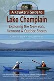
A Kayaker’s Guide to Lake Champlain is a book written by two Lake Champlain veteran kayakers but it's not just a guide for kayakers; canoeists, boaters or anyone who loves Lake Champlain will find it a great all-around guide.
Before you start on canoeing trip of any length, be sure that you're prepared by using a trip checklist. You can find a sample of a checklist for a canoe-camping trip here